Immersed in lush forests, the imposing Cima Piazzi glacier protects the Val Lia, the unmistakable symbol of Valdidentro.

Val Lia and Alpe Boron
From the church of Presedont in Valdidentro, take the road that runs alongside the little church on the right. Then, enter the forest along path N286. After a short winding stretch with varying gradients, you come to a fork in the road, which leads left towards the Ciuk.
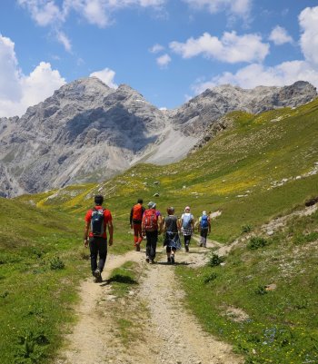
Instead, the path continues to the right and runs through the Val Lia, skirting typical mountain huts and offering spectacular views of Cima Piazzi glacier and its glacier several times until reaching the Agriturismo Alpe Boron, an excellent refreshment point.
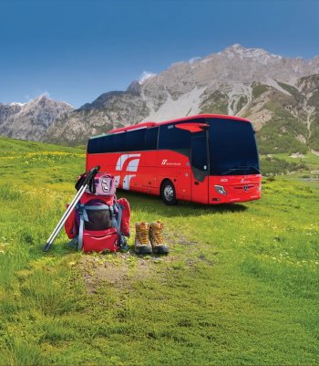
The excursion, although relatively demanding, is suitable for the whole family.
Please note: the access road to Val Lia is subject to vehicle traffic restrictions and requires a daily ticket year-round. In July and August, it is not possible to reach the Prescedont car park by car; however, you can purchase a ticket valid for the previous car parks, subject to limited availability. For information and details, please contact the Valdidentro Tourist Office: +39 0342 985331.
- Length: 2 Km 727 m
- Time: 1 h (bike: 30')
- Height difference: 308 m
Val Cardonè and Bivacco Ferrario
The Ferrario bivouac was built in 1956 as a support base for the ascent to the Piazzi summit. It was later renovated and replaced with a more modern artifact in 1988. A little further upstream, in the same area, is the Cantoni Bivouac, which is equally equipped and comfortable and an excellent starting point for climbing the Piazzi.
Embark on a thrilling westward journey from the little church of Presedont in Valdidentro. The trail, marked by N288, takes you beyond a small bridge and into a steep climb through dense forest to the Belvedere Hut, nestled in a secluded corner of the mountain. The track narrows and leads you into the Cardonè Valley, where a first hut awaits. Transforming into a wide mule track, the trail continues its ascent toward the Baite di Cardonè. A bridge allows you to cross the watercourse, and the trail gains elevation, leading you to the summit of the Corni di Verva ridge. To the right, a path to the Colle delle Pecore beckons. Instead, you take a left and, after crossing an area of rocky scree, you find yourself on a first plateau where, in the presence of the lowest tongues of the Vedretta dei Piazzi, stands the building of the Ferrario Bivouac, a testament to your adventurous spirit.
N.B. The access road to Val Lia is subject to vehicle traffic restrictions and requires a daily ticket year-round. In July and August, it is not possible to reach the Prescedont car park by car; however, it is possible to purchase a ticket valid for the previous car parks, subject to limited availability.
- Length: 5 Km
- Time: 2 h 26 m
- Height difference: 603 m


Giro Felice
The route, which connects Isolaccia to the Valle Bocciana through the Val Lia, is named after Felice Rocca, who first intuited the possibility of marking and climbing this route. The route is suitable for both trekking and MTB
Starting from the arrival of the gondola lift at Pian della Mota, you climb along a section of track and then immediately take the path to the right (N284.1) that crosses the forest and the Palancana ski lift, returning to the forest with a few hairpin bends, the route continues along the Alta Valtellina Bike Marathon route. Keeping to the right, you reach and cross Ponte Felice, heading towards the pastures of Alpe Pone through enchanting Swiss stone pine woods with panoramic views of Decauville. From here, you continue to the Ciuk locality, with views of the Cima Piazzi peak, then connecting with the Val Lia road. Following the signs, descend towards the little church of Prescedont, then continue along the asphalted road. After a short stretch, having passed the Baite di Pezzel huts, at the height of a small wooden hut, take path N286 on the left (a signpost indicates the direction), which enters the woods, leading directly to the Isolaccia Sports Centre.
- Length: 9 km 500 m
- Time: 3 h
- Height difference: 776 m
 Info & commuications
 Info & commuications
 Info & commuications
 Info & commuications
 Info & commuications