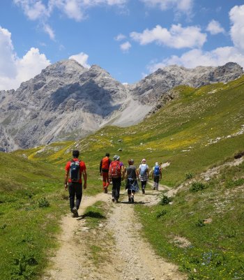
Explore the challenge of ski mountaineering on these demanding routes, navigating carefully through the enchanting snow-covered valleys.
Ski mountaineering is an extraordinary but inherently risky activity. It is essential to have the appropriate equipment, to know the terrain and the chosen route, and to have up-to-date information on weather and snow conditions. Carefully assess the difficulty of the route and the equipment required. Always carry crampons, an ice axe, and the ARVA emergency kit, shovel, and probe in your rucksack.
If you need advice, contact the Alpine Guides. They will guide you in your first technical steps and safely tackle the mountains. You can also ask for their advice about renting or buying equipment from specialized shops.

Cima Piazzi - Campaccio
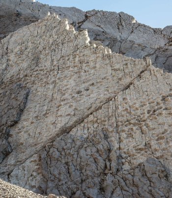
This beautiful ski mountaineering route climbs one of the most fascinating mountains in Alta Valtellina. The route up from Val Campaccio is very varied and requires good snow conditions in the upper, steeper section. The short final section is mountaineering without any particular difficulty. From the summit, a 360-degree panorama will surprise you.
From Monte, you ascend, following the little road to Campacciolo, passing by the Campello and Campello Alto huts. You then enter the Campaccio valley and arrive near the lake of the same name after overcoming a steep section. From here, continue westwards on terrain that gradually rises and then bends to the right over a steep section that leads to a small plateau; then climb up a gully to the right that narrows to a flat area. Now, diagonally to the right for a few hundred meters, climb up a steep, slightly concave slope leading to the southern ridge of Cima Piazzi. From here, staying to the left of the ridge, you will reach the eastern shoulder of the summit. Traverse the horizontal ridge westwards for about fifty meters to reach the base of the final rocky cusp. Leaving your skis on, you ascend more or less on the edge (grade II steps with anchors in place) and arrive briefly at the summit. DESCENT: along the ascent route.
- Length: 6 Km 760 mt
- Time: 6 h 56 min
- Height difference: 1.810 m
Monte Forcellina - Vallaccia Corta
This is a beautiful and challenging ski mountaineering itinerary due to the steep terrain on which the second half of the route takes place. From the summit, a 360-degree panorama will be the reward in addition to the steep descent that you will face.
From the parking area on the right, just past the two tunnels, on the Foscagno road, cross the road and start climbing parallel to the main road but passing close to the existing valley. You can also start a little further near the semi-curve of the road to the right. Continue in a south-westerly direction, thus entering Vallaccia Corta. After passing a short, steep section, we reach a vast plateau to the left of the stream. Once past the flat section, head to the right of the stream, and following a steep little valley to the west, you reach a broad false plain in the valley's center. The path bends slightly to the left, taking us to the base of the steep slope that leads to the visible triangular peak of Monte Forcellina. Climb up steep terrain following valleys and wide slopes, heading to the right at the top. From here, in a southerly direction with a final steep section to the summit.
- Length: 3 Km 589 m
- Time: 3 h 37 min
- Height difference: 937 mt


Cima Piazzi - Val Lia
The Cima Piazzi is the ski mountaineering route par excellence in Alta Valtellina. Its long ascent, isolated and challenging environment, and wide and steep slopes are some of the ingredients that will make this climb unforgettable. The 360-degree panorama from the summit is spectacular.
From the parking area at Isolaccia, climb following the beautiful little road that passes by the Baite di Pezzel huts and leads to the little church of the Madonna di Precsedont at 1750 m altitude. Following the signs for the Malga Boron hut, we again enter the beautiful larch and fir forest and shortly afterward begin to see the imposing northern slope of Cima Piazzi. Having passed the Boron huts, we continue along the hillside to a vast plateau. From here, cross the stream on the right and climb halfway up the vast slope facing east, arriving on the final stretch on the broad ridge of Dosso Peneglia. Now bending slightly to the right and returning slightly above, you arrive on the edge of the glacial moraine near the Cantoni bivouac. Slightly lose altitude by descending to the right to enter the amphitheater at the base of the glacier and ascending a steep gully on the left to reach the glacial falsopiano at the base of the central edge of the wall. One moves to the left of the edge and ascends along a steep slope that, with some very steep stretches, overcomes the most impervious glacial zone, arriving near the anticlimax. Skirting the small rocks to the right, one briefly reaches the summit. From the plateau after Boron, it is possible to continue to the left, climbing with a more direct route to the gully that leads to the left of the central edge of the wall, and from here, continue the ascent as for the previous itinerary.
- Length: 11 Km 220 m
- Time: 9 h 32 min
- Height difference: 2.085 m
Cima di Saoseo
Beautiful ski mountaineering in one of the most remote corners of the Val Viola, with considerable development. From the summit, an immense panorama sweeps from Alta Valtellina to the Grosina Valley and the Bernina group.
From Arnoga, follow the carriage road that runs halfway up the Val Viola, and after passing the turnoffs for Sattarona, Val Verva, and Stagimel, you come to a diversion after about 50 minutes. Leaving the road that climbs towards Altumeira, we descend on a snowy road to the Caricc locality, where just before, or shortly after, the Baita Caricc (1990 m) farmhouse, we cross the bridge over the Viola stream and climb to the right following the mule track that leads to the magnificent Dosdè plain. You then reach the Federico refuge of the CAI Bormio (2133 m), descend to the bridge on the right to cross the Viola stream and continue along the valley floor until you enter the Canton Dosdè valley. When you come to a bridge, do not cross it but continue to the right, thus entering the Canton Dosdè Valley; always staying at the bottom of the valley, continue along the stream, and continue even when the valley becomes flat. From here, you can see the itinerary that you will climb, referencing the sizeable left-hand gorge that you will climb first by bending to the left and returning to its base to the right. Having climbed the gorge and arrived on the crest, we go up the other side and halfway up the slope towards the west on moderate slopes to reach the summit.
- Length: 13 Km 347 m
- Time: 6 h 53 min
- Height difference: 1448 m


Monte Solena
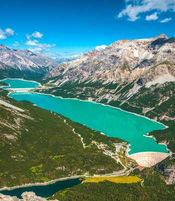
It is a beautiful ski mountaineering excursion with a medium altitude difference, which develops on steep slopes once you leave the wooded boundary. Although it does not reach an altitude of 3000 meters, Monte Solena is a fascinating mountain that forms the backbone at the end of the south ridge of the more famous and imposing Piz Schumbraida. Its squat triangular mass is already visible from the Bormio basin. From the summit, one can enjoy breathtaking views of the Val Fraele below with its artificial lakes of Cancano and S. Giacomo di Fraele, and of all the peaks in the surrounding area, in particular of the stratified and jagged Plator and Doscopa peaks, the beautiful northern slope of the Cima Piazzi, the Bernina group and the Ortles area, and further south, the Orobie Valtellinesi.
From Ristoro Solena, located near the little church of Cancano, we head to Grasso di Solena, following the lovely flat road. Then we climb up to the well-marked farmstead and, as soon as we pass it, take a few dozen meters to the right, where the summer path begins to climb into the dense thicket of mountain pines. After passing a hairpin bend, you arrive at a beautiful flat clearing. After crossing the entire clearing to the north, we again enter the forest until we reach another small clearing at the edge of the tree line. Continue climbing over open, steep terrain to reach a broad falsopiano, followed entirely to the left. From here, the terrain becomes steep again and is overcome by staying mainly on the right-hand edge, thus reaching a saddle located to the right of the gully. Circling the base to the left of the small rocks, you return to the ridge again and shortly reach the summit.
- Length: 3 Km 405 m
- Time: 3 h 46 min
- Height difference: 946 m
Cima di Lago Spalmo Orientale Nord
This is undoubtedly the most beautiful and pleasant ski mountaineering trip in Val Viola. It is a very varied and technical classic route with good development in a glacial environment in the upper part of the itinerary that requires a little caution and stable snow in some places. Giorgio Sinigaglia made the first ascent of this slope with Antonio Baroni and Pietro Rinaldi on 28 July 1897. The place name spalmo derives from spalm, a mixture of water and milk in the Grosine dialect. By the analogy of color, the glacial lakes with turbid water are called salmon instead of the black lakes of clear spring water.
From Arnoga, follow the carriage road that runs halfway up the Val Viola and past the turnoffs for Sattarona, Val Verva, and Stagimel; you will arrive at a turnoff after about 50 minutes. Leave the road that climbs towards Altumeira and descend along the snow-covered road to the Caricc locality, where just before, or shortly after, the Baita Caricc (1990 m) farmhouse, you cross the bridge over the Viola stream and climb to the right following the mule track that leads to the Dosdè plain. Then you go to the Federico in Dosdè refuge (2133 m), descend to the bridge on the right, cross the Viola torrent, and continue along the valley floor until you enter the Canton Dosdè valley. When you come to a bridge, cross it and climb up the vast, gently sloping, funnel-shaped slope to the left of the visible Bivacco Caldarini (2503 m). You skirt the evident rock on the right and, having arrived in a flatter area, turn decisively to the left, climbing a steep ridge, or even further to the left, a small valley that leads to the base of the western Dosdè glacier. One turns decisively to the left near the ridge and climbs the steepest part of the ascent. The last section slopes a little, and bending to the right, you reach a small mouth and to the left near the ridge and walk on the ridge to the summit (3262 m).
- Length: 12 Km 124 m
- Time: 7h 30 min
- Height difference: 1.408 m

 Press releases
 Info & commuications
 Info & commuications
 Info & commuications
 Info & commuications
 Info & commuications